
Inside the headquarters of the Tamil Nadu forest department in Chennai, pairs of television monitors glow side by side along rows of cubicles.One screen displays decades-old forest boundary maps, while the other shows the same landscape in its current, real-time spatial position. Officers carefully compare the two, verifying alignment and identifying even the smallest deviation before moving on to the next set of maps.
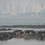
The exercise is part of an intensive statewide effort to digitize forest boundary maps, a process the department began more than two weeks ago.Officials hope the initiative will strengthen boundary monitoring, reduce land disputes and provide a reliable digital baseline for future conservation planning. With urban expansion and development pressures increasing around forest fringes, accurate spatial records are expected to play a crucial role in safeguarding natural habitats.Uniformed range officers, supported by foresters and guards, arrive at the information technology cell carrying physical maps from their jurisdictions.Working alongside revenue officials and technical staff from the TN e-governance agency, each boundary is examined for accuracy before being converted into a digital format.“Range officers and draughtsmen submit field maps for scrutiny at the IT cell. Once verified, the department’s technical wing uploads the data to create an authenticated digital record,” says state forest secretary Supriya Sahu. “If there is a mismatch between the historical map and the present ground position, the area is rechecked.”If discrepancies persist, revenue authorities document the variation and relay the details to the Tamil Nadu e-governance agency, which then updates the official spatial records based on field validation.“Cases involving encroachments and boundary conflicts are also forwarded to circle conservators and district forest officers for corrective action,” says Nihar Ranjan, chief conservator of forests (IT cell).In the Chennai region, digitization of the Pallikaranai marshland and forest areas under the Tambaram range has been completed, and no discrepancy has been found. However, divisions with a history of land pressure and encroachment, such as those in parts of Theni district, may take longer due to the need for detailed field verification, say officials.The department plans to complete digitization of the remaining forest divisions across the state by mid-March.